Before I started documenting the trip this morning I was on my sisters blog and read this quote by an unknown: “The only thing that stands between a person and what they want in life is the will to try it and the faith to believe it is possible.” This really hit hard inside of me and inspired what I am about to write.
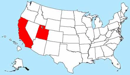
This trip was the yearly big adventure I always plan annually. My current goal, which will be an adventure for many years to come, is to step foot on the highest peak in each of the fifty states. So far I have two down and forty-eight to go. This last trip was to knock of Wyoming’s highest peak which sits in the middle of the Wind Rivers. The Winds in itself are one of the most beautiful mountain ranges in America. I will compare their beauty closely with our Uinta’s. With that said, here goes the trip report
Out of all fifty highpoints, Gannett Peak is one of the most remote to get to. It sits at an elevation of 13,804 feet above sea level. The best route according to guidebooks is to take the Elkhart Trailhead out of Pinedale Wyoming and hike twenty miles in, forty miles roundtrip. It requires 2 days backpacking for the approach and a full day of summiting. This hike will require a skill I have never used before and have been learning about for the past several months: Mountaineering! Hiking a trail is one thing; crampons, ice axe, ropes, glacier travel and snow is another reality of being in the outdoors. These skills I had to learn before leaving. I attacked the books, the Internet, friends, co-workers; just about anything to learn the skills. But the only thing that would teach me the things I needed was to be there, on the snow, on the ice, on the mountain itself! Oh, and the other lesson I learned on this trip; Safety is always number 1! At HOME and on the mountain. I didn't loose an arm, but I did loose a piece of equipment that turned out to be invaluable to have!!
It starts several days before leaving. I have put together a gear list and started packing my pack. First thing I did was laid out everything I thought I needed on the trip. Then I went through and pulled the unnecessary to decrease my pack weight. The next day I went through it again. Then I packed it all up and weighed the backpack. Fifty pounds! This was not acceptable. I went through it again and again, repacked and packed several times. After the fourth time I got it down to forty pounds. This was acceptable to my standard. Early Monday morning at 0600 I picked up Steve, Brett and Brett's neighbor Art. The four of us piled into my 4-Runner and headed towards the middle of Wyoming. Four hours of driving and five McDonalds Egg McMuffins later (all Brett), we finally arrived at the trailhead. The parking lot was packed with cars and as we started to unload, three HUGE van loads of people pulled in after us. We found out there were two missing hikers and a SAR (search and rescue) operation was in progress. Their command post was in the parking lot and everyone and their dog were getting ready to travel our same trail.


 It is a satellite communicator of sorts. It has three main functions. You push one button to send out an OK message. This message can go to either an email or text message with a predetermined message and the exact GPS coordinates of where I am when pushing the button. The message will also have a link to click on and show you on Google Maps where we are, either by satellite image or topographical map. I can go onto my account and put in the people I want to send the message to and what the message says. It's actually kind of cool. The other function is a "HELP" function. I hit that button and it sends out a message to those I pre-determined will come help me if I needed it. It's a message that says I am OK, but stranded. I would use this if I ran out of gas or broke down somewhere. The last function is a "911" button. If I hit this button, the GPS coordinate would be sent to Spot Tracker (the company) and they would immediately dispatch the closest search and rescue. This function is for the emergency, when I have injured myself or need help ASAP! It's kind of nice to know if I am out of cell phone range I can still communicate if I needed help, which is a great thing to have in the back country. So for an extra $30 a year, I can add another function which is called "tracking." It would send out a message with the GPS coordinate every ten minutes to my account. Chirsty was able to log on whenever she wanted and see exactly where we went and where we currently were. It was fun for her to watch our progress. I had this function mainly for summit day since that part of the hike was going to be VERY hard for us. Like I wrote earlier, I have used this device many times in the past. I would send out an OK message when I got to camp letting everyone know I made it OK. Then every night I would send out another OK message letting them know I was back at camp and doing fine. My parents especially like this because it gives them a sense of relief knowing my day of hiking was done and I was back at camp safe. So anyways, here is a picture from Photographers Point:

 Photographers Point was five miles in. Another five miles later and we would be at Seneca Lake, which was the stopping point for the day. On our 10 miles in we ran into a lot of hikers. Some of them fit the description of the two missing hikers so we always asked if they were the ones. Of course they were not so we chatted for a minute or two and moved on. One group we ran into said they had a tent at Seneca Lake set up for them in case they made it back to their camp. The tent had a note in it stating to stay there and wait for SAR. They had a sibling who made it out I guess and left the tent for them. He was the one who notified SAR of the overdue hikers.
 We set up our camp just north of the lake. About 100 yards from the lost hikers tent, which was the exact tent I have. Every couple of hours or so a helicopter would fly over, circle the tent, and fly off. We ran into many SAR people on horseback and foot looking for the hikers. It was a brutal ten miles in but glad to be at camp. I sent off my spot message stating we were at camp and started spraying up on bug dope since the little buggers were horrible. Sunset came and we were in our bags sleeping. The next morning we got up, broke camp and started heading for our next stop, six miles to Titcomb Lakes. I started the tracking mode on the spot tracker and off we went. About two miles in we ran into two hikers just below a pass. Once again they fit the description of the missing hikers so Steve asked if they were the ones. "Ya we are, but were found!" They started to move on and we all looked at each other like "Don't joke around people, this is kinda serious!" So Steve stopped them and asked again, and they stopped and sure enough, they were! We chatted with them for a bit. We asked if they were OK and if they needed anything. They were in good physical shape, mentally they were perfect, and they still had plenty of food and water. They apparently got snowed on going over a pass and missed their trail, sending them into another drainage. This set them back two days. They said they knew SAR was out looking for them because of their two days overdue. They even had seen the helicopter fly over several times and tried signaling it with no avail. We told them their sibling was OK and with SAR. We also let them know their tent was still set up at Seneca with a note stating to sit put. They were very appreciative of our information and sparked up at the thought of being at their tent in another mile or so. Since they were still in good shape and knew where they were and what they were doing we split our ways. When we got onto the pass we thought it would be a good idea to see if we had cell coverage and call the forest service to report our sighting. Luck would have it we did and we called. That was the first they had word the missing two were OK and their location. About five minutes later we heard the helicopter flying and sounded like it landed over by the lake. This event would prove helpful to us later in our journey! So on we went to Titcomb Lakes.


 We arrived at a good campsite above the lakes and set up camp. I sent off my OK message to let everyone know we had arrived at camp two OK and resting the rest of the day preparing for the big day.
 Looking north from our camp you can see the pass we have to travel over the next morning. The couloir to the far right of the pic below is Bonney Pass. 2,000 feet elevation gain to go up and over it into another drainage before ascending Gannett Peak. It looks steep, which it is! Ice axe and crampons are a must to travel this part. We came prepared!
 03:30 came early. Some of us slept well from hiking in 16 miles, some of us were too excited to sleep! But the time came for summit day. We loaded our packs with what we thought we needed and off we went into the dark, headlamps blazing our way.
 Since this day was going to be the most challenging day for us and the most dangerous, I had the spot tracker on and Christy was following our every move. Up Bonney Pass and down the other side. We were half way up the pass when it started getting light. I took a few pics to show the ordeal it took getting up.
 Here I am atop Bonney Pass looking north. Gannett Peak is rising in its glory behind me. Three hours down, many more to go! And I was not looking forward to going back down what we came up. It was freaking steep!!!
 So down the pass and onto Dinwoody Glacier. We traveled across that glacier towards Gooseneck Glacier. All day we were leap-frogging with a couple of other teams. One group was from Alaska, another from Oregon. There was one team, unknown where they were from, but had summited Rainer seven times and was hoping to bag this one. You can see the Alaskan team ahead of us in the pic below. The Oregon team were already up on the other glacier.
 Here we are crossing over the ridge from Dinwoody Glacier to Gooseneck Glacier. The "Rainer Team," what we came to call them, caught up to us here. This is the point we rope up, so all three of our groups were tying in and getting ready to hit the worst part of the trip: THE BERGSCHRUND!
 A "bergschrund" is the beginning of a glacier. Usually there is a snow field that comes down the top of the saddle and then a cravasse splitting the field to where the actual glacier begins. Sometimes there is no cravasse other times there is. This one had one. Usually in the early months there is a snow bridge that crosses over the cravasse. This is the only way to cross the bergschrund. In later months the snow bridge will melt off and there is no way to cross it. We inquired about it with passing hikers who had been up the day before. They said the bridge was still there and we had no worries. So the pic below shows the Rainer team (three of them) roped up heading towards the bergschrund and the Alaskan team (the next three) following.
 Here we are roped up and actually on the snow bridge. Art, at the top, is looking right at the massive cravasse. Brett is in the middle of the bridge and Steve is looking left towards the other side of the cravasse. At this point Steve tired out and called it quites. He unclipped and headed back down towards the ridge. This freaked me out because he was unclipping at a point he should not have. But he made it OK and we continued up and over the bergschrund. I took a picture of the cravasse towards the left, but when I got to the point looking to the right, I saw I was on a foot of snow going over the cravasse and did not want to stop! It freaked the crap out of me and I just kept on stepping. I think, no pretty sure, Brett was feeling the same thing because we both were cruzing up the glacier to get out of the area.
 A few more steps and we were up on the last saddle before the final ascent. At this point we were tired. We had come a long ways and over some pretty hairy stuff. Looking west the weather was bringing us a good thunderstorm. A guy was sitting there and we chatted with him. He said his team went on and he has been watching everyone else go up. From this point on he said it has taken everyone about an hour and a half to summit. Looking at the weather, seeing how tired I was and Brett not wanting to go any further I came to a decision. They always say to get up and down before the snowbridge over the bergschrund gets soft in the afternoon. It was already afternoon and another couple of hours would only place us in more danger of falling into that cravasse. I faced defeat knowing the mountain would be there another day and made the call. Art was disapointed. This was his second attempt on Gannett and he really wanted it bad. I told him if he wanted to go then go but we were turning around. He was off and running towards the summit! Me and Brett stood there wondering what to do next. I visited with the gentleman a little bit longer then headed down off the saddle a bit to wait for Art. I didn't want to be up there when the thunderstorm hit and wanted to be a bit protected. We sat on a small ridge and watched as everyone came down and Art went up.

 Team after team passed up going down. Art barely made it to the summit before the last ones were going down so he had someone to take his picture on the top. By the time he made it back to us the storm blew to the north of us and nothing hit. He made a gamble and it paid off for him. I made a decision based on safety and missed the opportunity to summit. Did I regret making that decision? Not one bit, like I said, the mountain will be there another day. Thats not to say it doesn't hurt not bagging it! It feels much like those who love to waterski and have their boat sink to the bottom of the lake. A gun fanatic having all his guns and ammunition stolen. A family history buff having all the documentation of generations upon generations of relatives go up in flames. A hockey player being told he could never walk again. Ya, it hurts, but at least I am alive and living to see another day and hopefully another summit. So we all met up with each other again and started back down Gooseneck Glacier. Ya it was scary and hairy coming back down the snowbridge but we made it OK. As we headed over Dinwoody Glacier back towards Bonney Pass another little storm rolled in and it started to snow on us. Nothing heavy, just a few little flakes. Up and to the pass we went. The final step of the day, down Bonney Pass. This was a challenge within itself because it was already late afternoon and the sun had made the snow into mush. It was VERY steep and was going to be VERY hard going down. Art took off his crampons and slid down on his butt, using his ice axe to brake. Steve used a technique of skating backwords and using the ice axe as an anchor. Brett slid down on his stomach using the self arrest move. Me? I couldn't master any way of getting down. I was tired. Dead tired. I didn't feel safe and secure using any mode. When I tried to slide on my stomach using the self arrest move I wouldn't go anywhere, which I guess was good because the skill is designed to stop you from sliding. So I down stepped it, one step at a time. However, it was so steep I wasn't downstepping as much as sliding down on my knees using the ice axe and crampons each step. It took FOREVER!!! Art and Brett were already back at camp by the time I made it down. Steve was a good brother and waited for me. I think I forgot to tell you I ran out of water coming down from the saddle and grabbed the wrong bag of food. So the whole day Steve shared his water and I hauled up a bag of garbage instead of food. That is why I was so tired. So here I was at the bottom of this very steep bowl. Glad I was done with the hard stuff. Only another hour of hiking and we would be back at camp. Before heading off I asked Steve to make sure the spot tracker was still on the pack. IT WASN'T!!!!!! Now begins the part of the trip where everyone else at home gets involved. So being summit day, Christy was in front of the computer watching us go up and over Bonney, down Dinwoody, over Gooseneck and up to the saddle. Back down Gooseneck and back over Dinwoody glacier and up to Bonney Pass. Down the very steep Bonney Pass and then NOTHING! There the tracking stops. There the satalite continues to ping and send off messages showing we have stopped at the bottome of a coulier. A very steep cliff of sorts. As she is sitting at home wathcing us sit at the bottom of this cliff, we were so tired we continued to camp. I last saw the spot tracker on the other side of Bonney and had no idea where it had fallen off. I was too tired to go back up the pass to look for it. We would rest and see what the following day would bring. Here is a pic looking back up the pass after realizing I lost the spot tracker:
 The next morning came. We got up and got some food in us. Me and Steve talked about the scenario we were in. Knowing Christy was at home looking at the spot showing we were still at the bottom of this cliff we had to either go find it and send off the OK message or high-tail it out to where we could get cell coverage to let her know we were OK. I was hoping she wasn't looking at the computer wondering if we all slid to our death but as luck would have it, she was. I was beat. I had little energy left. Not knowing where exactly the spot tracker was and not really wanting to go back up Bonney Pass we decided to pack up and high-tail it out. So thats what we did! As I packed in as much food as I could eat knowing I needed as much energy as possible, Steve rested knowing it was going to be a hard and fast hike out.
 As we hiked a storm rolled in. It snowed and rained on us but we continued to move. We knew we needed to get to cell coverage to call Christy so she wouldn't freak out and call SAR.
 We finally made it to the pass where we called the forest service the other day to report the two missing hikers we found. I didn't have coverage on my phone but Steve did. He called Darcie and all I heard was "Really, crap; I'll have him call her right now!" So here is where the trip gets interesting:

 We made it to the trailhead about 21:15 that night. My parents had already been there and left a note on the windshield stating they were in town. We packed up our bags and headed down to Pinedale. When we got into town we called and met up with them at their hotel room. Mom was very, VERY, VERY happy to see her kids again. After discussing the events and how they transpired we came to an agreement it all happened for the best. Anyone who may think anyone over-reacted was not in the shoes of the person seeing all the information presented. I personally am glad the events happened the way they did. I have learned many new things with this trip. And like Murphy's Law states; "Experience is something you don't get until just after you need it!"